GISTDA warns that large parts of Bangkok, Pathum Thani and Nonthaburi could face flooding as the Chao Phraya River overflows and sea levels rise.
The Geo-Informatics and Space Technology Development Agency (GISTDA) has warned that vast areas in Bangkok, Pathum Thani and Nonthaburi are at risk of flooding from the overflow of the Chao Phraya River and its tributaries.
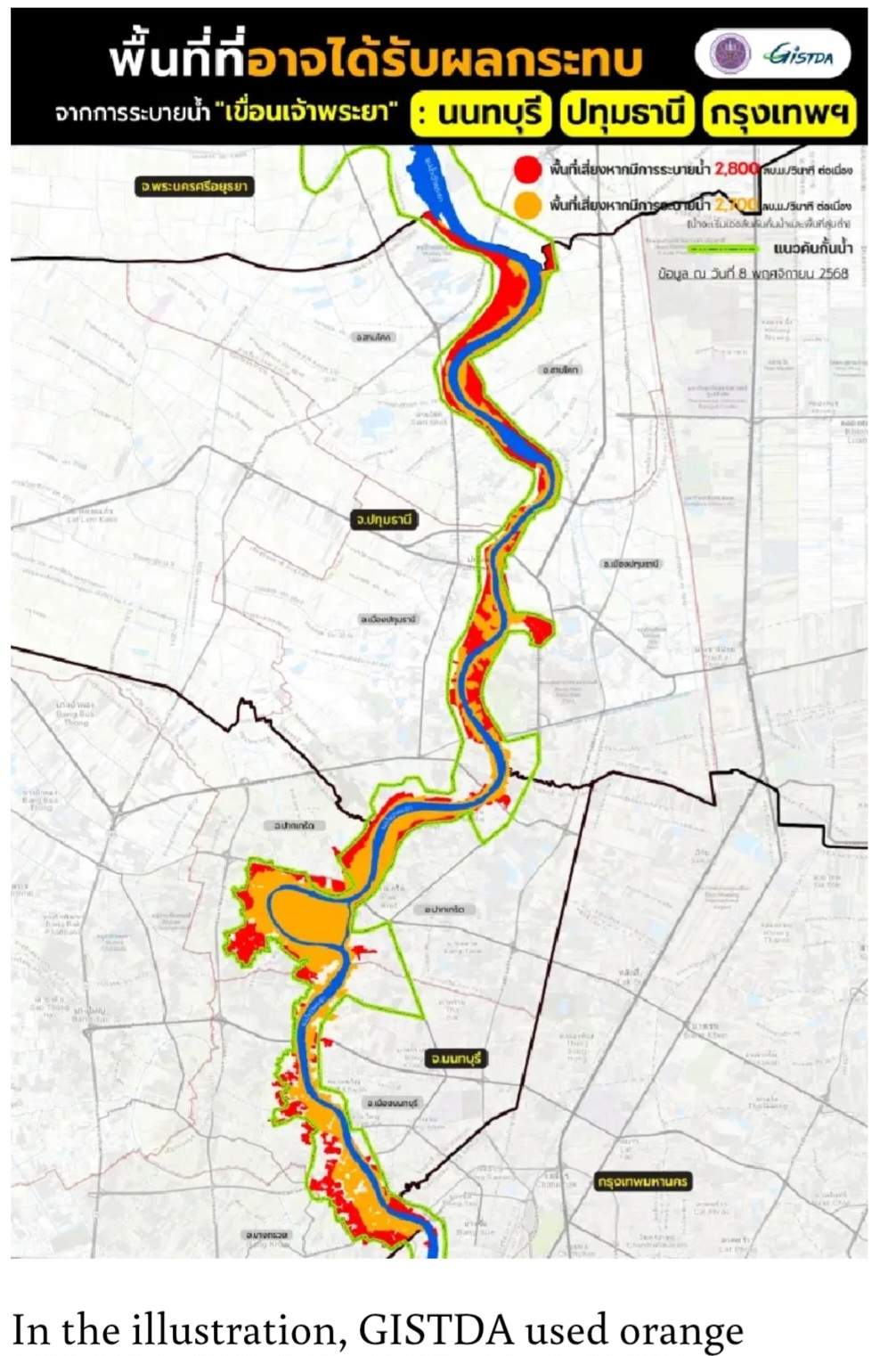
GISTDA released a map illustration on Saturday showing large areas along the Chao Phraya River — from Pathum Thani downstream through Nonthaburi to Bangkok — that could be inundated by overflowing water.
The agency noted that these areas lie outside the permanent flood levees built by authorities to protect riverside communities.
In the illustration, GISTDA used orange shading to highlight areas that would be flooded if the Chao Phraya Dam released water at a rate of 2,700 cubic metres per second.
Areas marked in red lie beyond the orange zones, representing regions that would be inundated if the dam’s discharge increased to 2,800 cubic metres per second, the agency said.
GISTDA added that the situation could worsen with the rising sea tide.