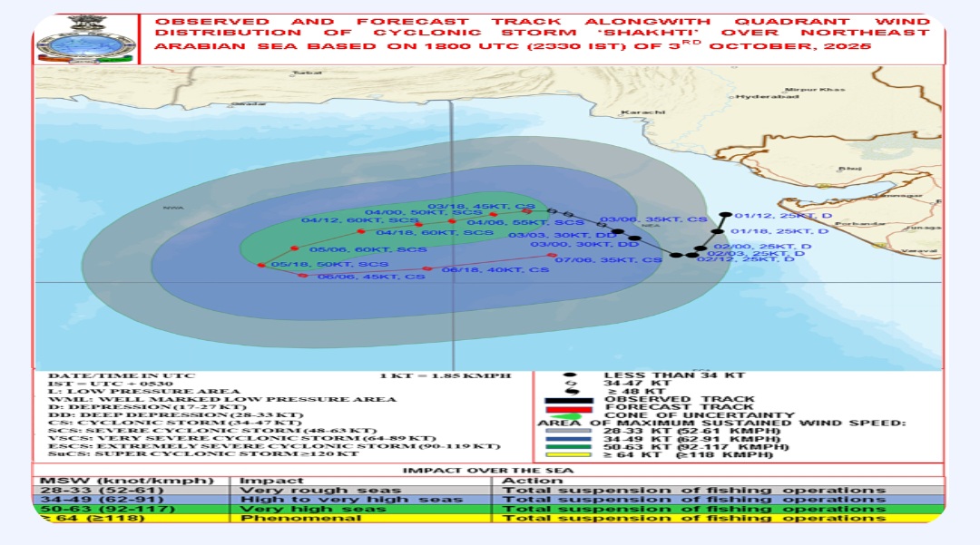
India Meteorological Department IMD has said that Cyclonic Storm Shakhti lay centred about 340 kilometres west of Dwarka in Gujarat. It said, the Cyclonic Storm is likely to move west-southwestwards and intensify further into a severe cyclonic storm today.
IMD said, it will reach central parts of the north and the adjoining central Arabian Sea by tomorrow. It will recurve and move east-northeastward on Monday.
Meanwhile, in Uttar Pradesh heavy rain and waterlogging has disrupted normal life in many districts. Varanasi recorded the highest rainfall yesterday in the last 135 years.
Meteorological Department has issued an alert of heavy rain in eastern part of the state.
Due to Western disturbance and low-pressure situation eastern parts of the state are witnessing heavy rain for last 24 hours.
Normal life is disrupted because of waterlogging in streets and incidents of trees falling on roads and highways. One people died in Ghazipur district due to lightning while three others got injured.
Met department has issued alert for heavy rain in the next 24 hours for the 32 districts of the state, which fall mostly in the eastern region.
In the wake of the alert and the present weather condition,s schools and colleges till 12th are closed in many district,s including Sonbhadra and Jaunpur.
Cyclone Shakhti, the first cyclonic storm in the Arabian Sea in the post-monsoon season, was moving towards Dwarka off the Gujarat coast on Friday and was expected to intensify further, the weather office said.
The cyclonic storm over the northeast Arabian Sea moved west-northwestwards with a speed of eight kmph during the last six hours, and lay centred at 2030 hrs IST on Friday, over the same region, nearly 300 km west of Dwarka, 330 km south-southwest of Karachi (Pakistan) and 360 km west of Porbandar.
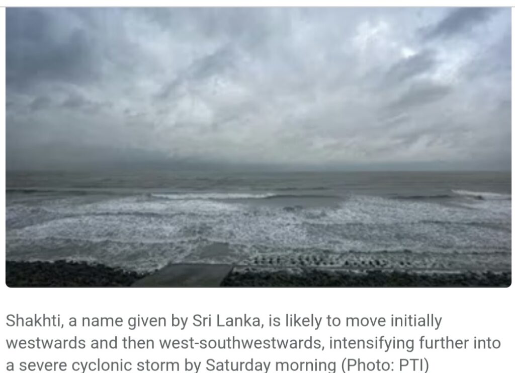
Shakhti, a name given by Sri Lanka, is likely to move initially westwards and then west-southwestwards, intensifying further into a severe cyclonic storm by Saturday morning.
“Thereafter, it is likely to continue to move west-southwestwards and reach central parts of north and adjoining central Arabian Sea by 5th October,” the weather bulletin issued by the India Meteorological Department said.
Under the influence of the cyclonic storm, sea conditions are very likely to be rough to very rough along and off the Gujarat-north Maharashtra coast and Pakistan coast till Sunday.
The weather office has warned fishermen not to venture into the northwest Arabian Sea, adjoining areas of the northeast Arabian Sea, central Arabian Sea and along and off the Gujarat-north Maharashtra coasts until Tuesday.
In recent years, storms like Tauktae (2021) and Biparjoy (2023) have formed in the Arabian Sea, which has witnessed fewer cyclones compared to the Bay of Bengal.
According to the current forecast, the cyclonic storm is likely to remain offshore and intensify over the next two days. It is expected to lose steam from Monday morning onwards, the weather office said.